The 3D Elevation Data Program is a Game-Changer
For decades, engineers have relied on a patchwork of data consisting of field surveys, orthographic photos, and other sources to piece together baseline topographic data for infrastructure design…
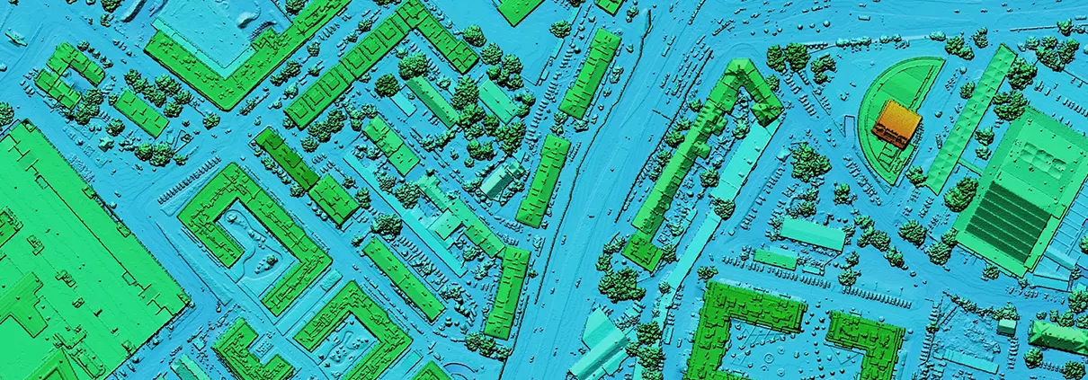
For decades, engineers have relied on a patchwork of data consisting of field surveys, orthographic photos, and other sources to piece together baseline topographic data for infrastructure design…
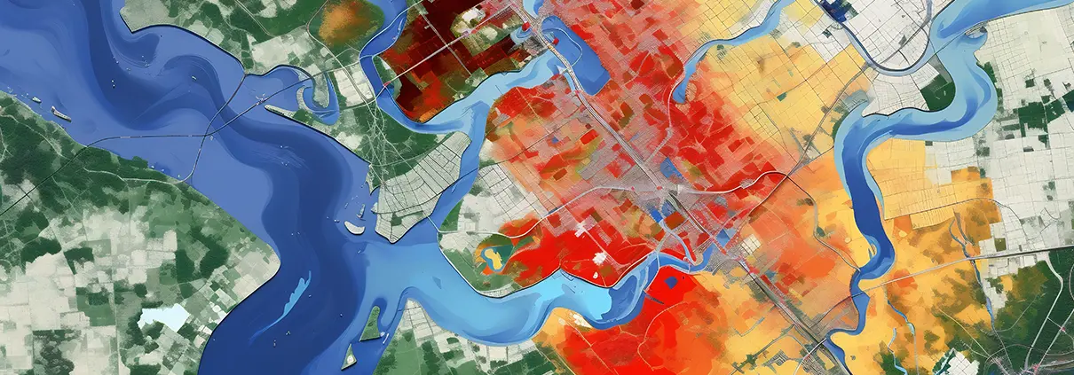
As cities grapple with flood preparedness, a strategy known as “stochastic storm transposition” (SST) is increasingly viewed as a tool useful for flood risk assessment. Today, the method…

If only the most alarming trends we are witnessing lately—warming oceans, heat waves in the Arctic and record high temperatures elsewhere—could be credited to normal fluctuations. But the…

I loved to take things apart when I was a kid. This penchant for disassembling household items was not appreciated by the adults in my life. On one occasion when I was 5 years old, I remember being very firmly directed by an exasperated HVAC technician to remove myself from the room where…
Read more
CC BY-SA 3.0, Link The 16th century was a pivotal time in the history of mapmaking. By the 15th century, Europe was already deep in exploration and conquest. Marco Polo had already inspired an age of discovery and travel with his historic trip to China. Portugal had established itself as a power at sea…
Read more
How do the basic bonds within a company mimic relationships found in nature? A company’s strength is to a large degree derived from the quality of the bond between employer and employee. If the employee, whether a physician, dog walker or factory worker, feels that his or her interests are respected and…
Read more
So how gritty are you? And maybe more importantly, how gritty are your employees? I stumbled across a TED talk on the topic of “grit” the other day. A. L. Duckworth from the University of Pennsylvania along with her colleagues had studied the topic extensively, tracked the success of students with “grit”…
Read more
I’ve had more than one experience where after bringing home some new gadget requiring a bit of technical expertise to install, I am disappointed to find the directions sorely lacking. A quick phone call to technical assistance gives me only a shred of new insight on how I can use the product…
Read more
Throughout history, people have tinkered with some form of map making. The first depictions of place by early civilizations, such as those found in the Lascaux caves in France dating back some 20,000 years ago, were carved in rock with simple lines and symbols. Later drawings on clay tablets added additional features…
Read more
Dec 28, 2016 Release For this release of GeoHECRAS, after getting lots of feedback from our users, we have introduced several major new features that improve and speedup the workflow of the HEC-RAS modeler. For example, the software will automatically interpolate the 3D river geometry from the defined HEC-RAS cross-sections and provided ground…
Read moreAll trademarks and logos are the property of their respective owners and are used here for reference purposes only. Rumor has it that UK oil group BP spent close to $150,000 US dollars on logo design before launching the now instantly recognizable sunflower logo in 2001. British Petroleum adopted this new logo and…
Read more
Free stuff comes in many different forms. Sometimes there are legitimate, useful things to be had for free. Consider the scores of handy apps to be downloaded free of charge that perform any number of useful tasks. And then there is the pretty ridiculous stuff, designed to lure in anyone with a…
Read more
It takes only a few substandard hires to bore a hole into your bottom line. It’s actually amazing how much money a company can lose over a few employees who don’t work out. So, like other businesses that champion onboarding and other strategies, I try to create an environment that will help…
Read moreWe use cookies to give you the best online experience. By agreeing you accept the use of cookies in accordance with our cookie policy.

When you visit any web site, it may store or retrieve information on your browser, mostly in the form of cookies. Control your personal Cookie Services here.