The 3D Elevation Data Program is a Game-Changer
For decades, engineers have relied on a patchwork of data consisting of field surveys, orthographic photos, and other sources to piece together baseline topographic data for infrastructure design…

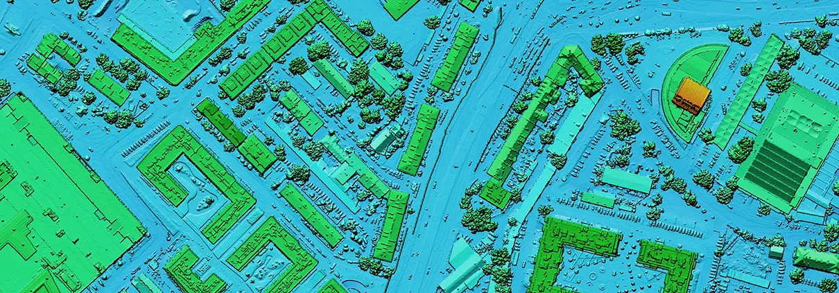
For decades, engineers have relied on a patchwork of data consisting of field surveys, orthographic photos, and other sources to piece together baseline topographic data for infrastructure design…
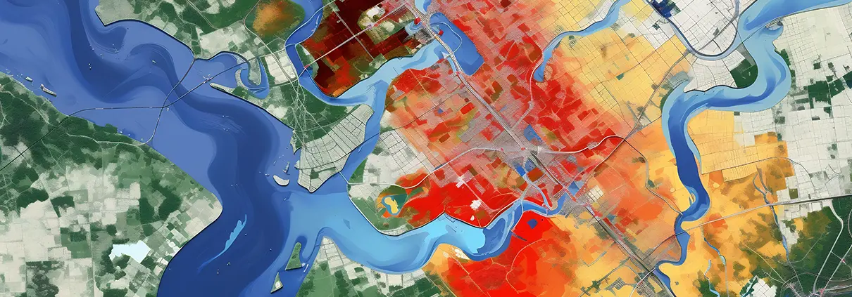
As cities grapple with flood preparedness, a strategy known as “stochastic storm transposition” (SST) is increasingly viewed as a tool useful for flood risk assessment. Today, the method…

If only the most alarming trends we are witnessing lately—warming oceans, heat waves in the Arctic and record high temperatures elsewhere—could be credited to normal fluctuations. But the…

Forbes recently published a story on research by Karen Huang, a Ph.D student at Harvard, that suggests that people who ask questions, particularly follow-up questions, may become better managers, land better jobs, and even win second dates. Huang designed a study that examined whether asking questions at a first meeting improved the relationship or made no…
Read more
Fights over water are pretty common these days. The San Joaquin River in California, for example, is in the thick of disputes between farmers, cities and other uses as a variety of groups attempt to restore the fishery and other aspects of a historically battered river. The recent North Dakota pipeline crisis…
Read more
Robust Math Skills Engineers know that mathematical relationships form the building blocks of all that we see in nature. The famous British mathematician, engineer and computer scientist, Alan Turing, was so talented in math as a child that he could solve advanced math problems with little to no exposure to introductory calculus.…
Read more
Dec 28, 2017 Release We are pleased to announce a major new release that contains numerous new features, enhancements, and functional fixes for GeoHECRAS. Many of these items came from receiving valuable feedback from our users. This new release took much longer than we expected, as the 2D modeling capabilities that we added…
Read more
Let’s declare right here what we all know to be true: Without a decent corporate phone system, businesses would go belly-up. An efficient, fool-proof phone system keeps the wheels spinning and business moving right along. Following in at a close second are the computers at CivilGEO, without which we couldn’t create the…
Read more
An engineer’s ability to tackle a complex modeling project requires accurate and reliable baseline data. Centuries of discovery, research, and human ingenuity have produced data in the form of LIDAR, satellite imagery, digital elevation terrain data, GIS and more. But, this huge variety of data has not always been available. As this…
Read more
Ideally, we should give thanks every day for the people, things and circumstances that make our lives better. But life and responsibilities get in the way most of the time. When the month of November rolls around, it forces us to consider the blessings we so often ignore during the rest of…
Read more
Looking at the years between 1971 and 2010, this team used several different computer simulations to measure the degree to which human activities or interventions (including irrigation, land use changes, water withdrawals, reservoir management) alter water supply either favorably or unfavorably for communities downstream. The main question being investigated was the following:…
Read more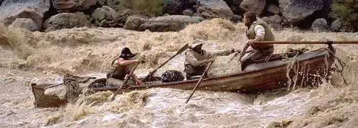
photo courtesy Philip Greenspun “We are three quarters of a mile in the depths of the earth, and the great river shrinks into insignificance as it dashes its angry waves against the walls and cliffs that rise to the world above… We have an unknown distance yet to run, an unknown river…
Read more
“We had accomplished an object of laudable ambition, and beyond the strict order of our instructions. We had climbed the loftiest peak of the Rocky Mountains, and…standing where never human foot had stood before, felt the exultation of first explorers.” John C. Frémont around 1842(Jackson and Spence, 1970, p. 45). Photo By Charles…
Read moreNous utilisons des cookies pour vous offrir la meilleure expérience en ligne. En acceptant, vous acceptez l'utilisation de cookies conformément à notre politique en matière de cookies.

Lorsque vous visitez un site web, celui-ci peut stocker ou récupérer des informations sur votre navigateur, le plus souvent sous la forme de cookies. Contrôlez vos services de cookies personnels ici.